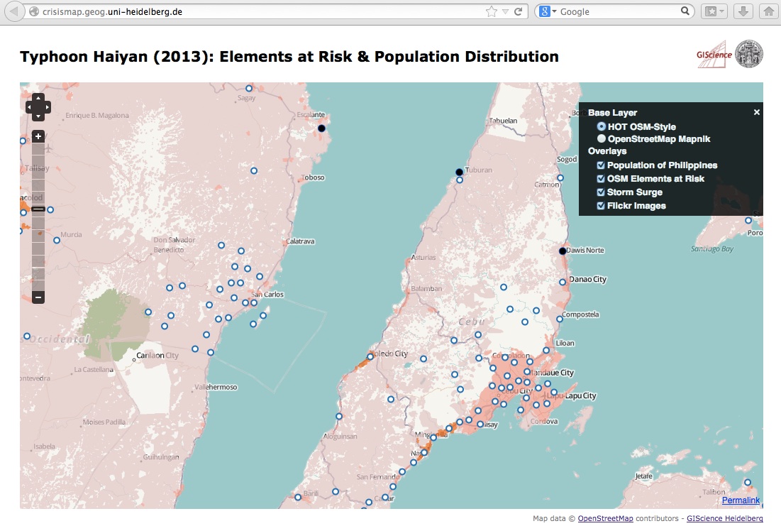
- A new WebSite http://crisismap.geog.uni-heidelberg.de that visualizes new map layers (“Elements at Risk” and “Population Distribution” for the Philipines). Further it adds a currently less populated Flickr layer and a storm surge layer on top of the H.O.T. base map.
- Due to a request by the crisis mappers also a simple table with the “Elements at Risk“ has been made available as csv-file:
http://129.206.228.92:8080/geoserver/LiveGeo/ows?service=WFS&version=1.1.0&request=GetFeature&typeName=LiveGeo:planet_osm_gadm&maxFeatures=50&outputFormat=csv
- An OSM Mapathon for generating a street map of the affected areas:
http://k1z.blog.uni-heidelberg.de/2013/11/12/uni-heidelberg-osm-mapathon-for-typhoon-yolandahayian-thursday-afternoon-november-14th-2013
- A live layer of Instagram images; it’s also available as a WFS/WMS layer here.
Please let us know if you have got any further data to integrate or ideas on improvement! Here are my contact details:
http://www.geog.uni-heidelberg.de/personen/gis_resch.html